A large portion of the Southside has received a grant from Local Initiatives Support Coalition. A map of the region is posted below, as it is bounded by Meridian, Raymond, I-65, and I-465:

Notice there are 2 large community assets in this neighborhood: Garfield Park and University of Indianapolis. Garfield Park is set to receive some new interactive sculptures, courtesy of Big Car:

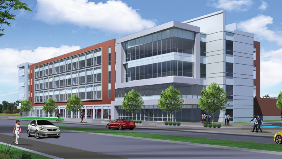
As for the University of Indianapolis, they’re setting their sites on a large redevelopment plan of their own, centered around the proposed Health Services Center:
There are also many challenges in the area, including devalued old strip centers, and lack of attractive streetscapes. Grants such as this can hopefully aid the area in building on its assets and mitigating its weaknesses.
Great things happening on the southside!
I’ve always envisioned a rail-trail connecting downtown to University of Indianapolis. A light-rail would run from the new transit center towards Fountain Square via Virginia Ave. once to Fountain Square, the rail would follow Shelby St. to UIndy where it then follows the path of the current railroad to Greenwood. The rail-trail would run on the current CSX elevated railroad from downtown (around South Street near CityWay) all the way to UIndy where it then meets up with the proposed light-rail. The light rail would connect downtown to Greenwood and run through Fletcher Place, Fountain Square, eastern edge of Garfield Park, UIndy, and Southport. The rail-trail would also connect downtown to Greenwood but run through CityWay, Bates-Hendricks, and the western edge of Garfield Park.